bp+Bryce PachecoUAS · GIS · TECHNICAL SYSTEMS
OPEN TO UAS & GIS OPPORTUNITIES

Bryce Pacheco.

A different perspective. A practical advantage.

AVIATION MINDSET.
HANDS-ON EXPERIENCE.

I connect flight, spatial data, and technical systems to make the view from above useful on the ground.

Get to know my work ↗
01 / PERSPECTIVE

See the
bigger picture.

From aerial imagery to ArcGIS analysis, I turn raw information into maps and visual products that support practical decisions.

02 / PRECISION

Understand
every connection.

I work across code and hardware: custom GPS flight logging, robotics, sensing systems, soldering, and hands-on integration.

03 / EXECUTION

Bring it
into the field.

Careful flight planning meets real inspection work. I combine operational discipline with clear documentation and client communication.

THE PERSON BEHIND THE WORK
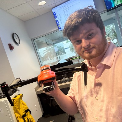
Bryce Pacheco holding a droneUAS IN PRACTICE
FAA PART 107 ↗
GIS & MAPPING +
SYSTEMS & SENSING +
A FOUNDATION IN FLIGHTEmbry-Riddle
Aeronautical University

B.S. Uncrewed Aircraft Systems
Minor in Geographic Information Systems

Start a conversation ↗
01Information.
Made actionable.
ArcGISPhotogrammetryGeographic databases
MAPPING & GEOSPATIAL ANALYSIS
02Built with
an engineer’s curiosity.
GPS flight loggingUAS roboticsHardware integration
APPLIED ACADEMIC WORK
03Prepared.
Documented. Delivered.
Aerial roof inspectionsRisk assessmentClient coordination
PROFESSIONAL FIELD EXPERIENCE
SCROLL TO MEET BRYCE
ONE PERSON. CONNECTED CAPABILITIES.

A pilot’s discipline.
A builder’s curiosity.
A collaborator’s mindset.

I’m building a career at the intersection of uncrewed aviation and geospatial technology. My experience spans flight operations, aerial inspections, mapping, and technical integration—with a focus on doing useful work, and doing it carefully.

EXPERIENCE / APPLIED WORK

Proof in the practice.

A few ways I’ve brought technical thinking into the real world.

01 / PROFESSIONAL EXPERIENCE

Aerial inspection.
Clearer documentation.

Conducted drone roof inspections for storm and structural damage assessments. Coordinated with clients, insurance adjusters, and project teams, while managing records and follow-up in JobNimbus.

Flight operationsAerial imagingField coordination
02 / APPLIED ACADEMIC WORK

Systems that connect.
Data that tells a story.

Developed custom GPS-based flight-logging code and worked with UAS robotics components. Built practical skills in soldering, servos, sensing systems, and hardware integration.

RoboticsGPS loggingIntegration
03 / APPLIED ACADEMIC WORK

Complex information.
A useful view.

Used ArcGIS to analyze geospatial data, create maps, and manage geographic databases. Combined shelter and infrastructure information into visual products for planning.

ArcGISSpatial analysisData visualization
THE FOUNDATION

Built on learning.
Grounded in responsibility.

01

Embry-Riddle Aeronautical University

B.S. in Uncrewed Aircraft Systems, degree candidate.
Minor in Geographic Information Systems.

02

FAA Part 107 Remote Pilot

Flight planning, safety risk assessment, LAANC workflows, TFR awareness, and operational compliance.

03

Leadership with accountability

Project planning, team coordination, and community service experience. A practical commitment to clear communication and follow-through.

Explore my full professional profile ↗
LET’S BUILD WHAT COMES NEXT

Your next project.
My next contribution.

Looking for a thoughtful remote pilot, a geospatial perspective, or someone who enjoys getting technical systems to work? Let’s talk.

[email protected]